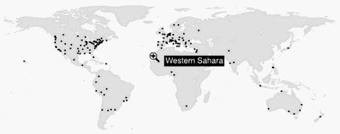
OpenLayers makes it easy to put a dynamic map in any web page. It can display map tiles and markers loaded from any source. MetaCarta developed the initial version of OpenLayers and gave it to the public to further the use of geographic information of all kinds.
OpenLayers is a pure JavaScript library for displaying map data in most modern web browsers, with no server-side dependencies. OpenLayers implements a JavaScript API for building rich web-based geographic applications, similar to the Google Maps and MSN Virtual Earth APIs, with one important difference – OpenLayers is Free Software, developed for and by the Open Source software community.
As a framework, OpenLayers is intended to separate map tools from map data so that all the tools can operate on all the data sources.

Requirements: Javascript Enabled
Demo: http://www.openlayers.org/
License: BSD License
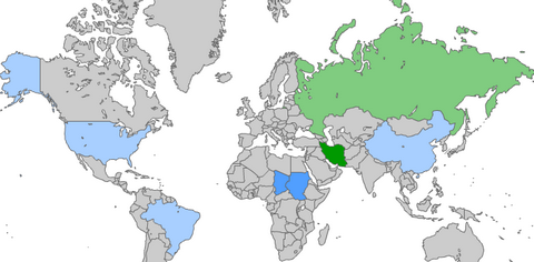
Jayhan present you the vector dotted world map free for download. It comes with three different dot sizes which is fine, medium and large to cater for different purpose and needs. This dotted world map is based on the world map resource from Deviant Art, and Jayhan overlay a dotted pattern on top and slowly remove the unwanted dots to form the shape of the world. It took Jayhan several days to accomplish this. UK was missing in the map. However, Dotted world map vector V1.1 has now included UK as well.

Requirements: –
Demo: http://www.jay-han.com/2008/01/06/dotted-world-map-vector…
License: License Free
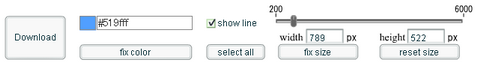
Printable World Map is free of charge. You can use Printable World Map for Web site, Publication, TV, Education, Work, anything you like. Follow the easy steps, you can have your own colored world map in no time.
- Click one or some countries, which you want to paint.
- Select the color from the color palette. You will have clicked color, and the State’s color will change.
- Click the “Fix color” button, if you will have liked color.
- It repeats from 1 to 3.
- Finally, click the “Download” button. Then you get printable world map.
Requirements: No Requirements
Demo: http://english.freemap.jp/world_paint/world_paint.html
License: License Free
The ZebraMap time zone map is a free, customizable map that you can use on its own or as part of a blog or web site. You can pick from twenty color schemes, add locations and position the labels. The map initially comes with ads at the bottom. If you would like to remove the ads from your map you can do so for a small fee.
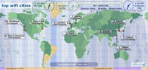
Requirements: Modern Browsers with Javascript Enabled
Demo: http://www.zebramap.com/
License: License Free
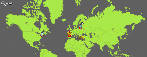
With maps.amung.us you get to see exactly where your site visitors are from – live! The maps update themselves on your site without having to reload the whole page. The maps are customizable which you can choose different backgrounds, pin shapes and color schemes. Embeddable maps are available in two sizes, a full size version and a smaller version for sites that have lesser space. Just copy the code into your website to get it working.
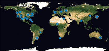
Requirements: No Requirements
Demo: http://maps.amung.us/
License: License Free
DIY Map is a clickable, zooming map written in Flash and colored by data from an external text file. The external data file makes it easy to customize and update state colors, add points, and use the same Flash file many times in the same Web page with different data sets. You can have a world map, USA map or Asia map,etc. It is free for personal, educational, and non-commercial use.
Requirements: Internet Explorer 6.0+, Firefox 0.8+, Safari 1.2.4+, Netscape 7.1+, Mozilla 1.4+, Opera 8.02+
Demo: http://backspace.com/mapapp
License: License Free for Non-Commercial
Yahoo! Maps enable you to make your web site or application come alive with the rich content and dynamic user interaction. Integrate a store locator with a few lines of code, view highway traffic patterns, or create custom routes — whatever you can dream of. Yahoo! Maps’ built-in Geocoder enables you to specify an address or latitude/longitude coordinates: no need to call an additional service or write special code. It is very similar to Google Map which is very powerful and easy to use.
Requirements: Flash 8.0+
Demo: http://maps.yahoo.com
License: License Free
AmMap is a web based interactive flash map creation software. Click on the points on the map to see possibilities of this tool. Use this tool to show locations of your offices, routes of your journeys, create your distributor map. You can zoom in and out easily. Photos or illustrations can be used instead of maps, so you can make different presentations, e-learning tools and more. You can use your own maps or choose from World, Europe, USA, Asia, North and South America, Australia and other maps which come together with this software.
Requirements: PHP 4.x+ and mySQL 4.3.x+, Flash 7+
Demo: http://www.interactivemaps.org/demo/ammap_admin
License: License Free for Non-Commercial
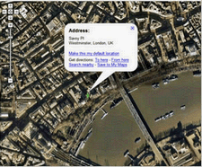
Google Maps are dynamic, interactive maps that you can drag — no clicking and waiting each time you want to view the adjacent parts of a map. Type in the name of a region or neighborhood and see any part of it as easily as with a regular street map. Use your mouse or the directional arrows to pan left, right, up and down to see areas that are hidden offscreen. Use the slider to zoom in and zoom out or press the + or – keys. You can also use satellite view, which gives you access to satellite and aerial images that you can zoom in, zoom out, or pan in any direction. You can create personalized, annotated, customized maps, complete with placemarks, lines or shapes. Add additional content including rich text, photos, videos and then share your map with others or open it in Google Earth.
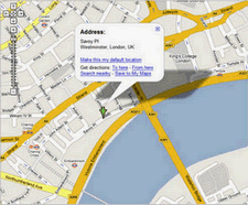
Requirements: Internet Explorer 6.0+, Firefox 1.0+, and Opera 8.0+, Safari 1.2.4+
Demo: http://www.google.com/apis/maps/
License: License Free